
Communities like the Enumclaw Plateau, Issaquah and the Snoqualmie Valley will need a blend of strategies to face growing wildfire risks over the coming decades, according to a wildfire strategy report recently completed by King County.
That’s the big takeaway from the region’s first Wildfire Risk Reduction Strategy, a blueprint for managing and deterring wildfire risk as climate change leads to more extreme weather events.
King County Executive Dow Constantine announced the report July 26. It focuses primarily on parts of the county called “wildland-urban interfaces” — in other words, places where people and infrastructure intermingle with or live right on the edge of the woods and wilderness.
Around 15% of King County residents live in the wildland-urban interface, according to the county.
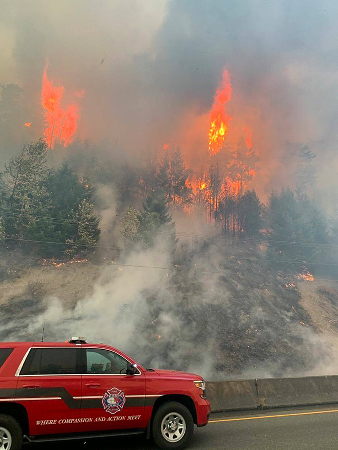
And among the greatest risks of living against the woods and hills is wildfires — 85 percent of which in Washington are caused by people, according to the state Department of Natural Resources.
“The potential for (very large, fast-moving) fires, while still low in any given year, is expected to increase as we experience hotter, drier summers,” the report reads.
King County had around 37 “very high” fire danger days each year, on average, from the 1970s through the 1990s. From 2010 to 2039, the county is shaping up to have about 45 per year, and is projected to have roughly 54 “very high” fire danger days by 2050 or so.
Annual “Extreme” fire danger days, similarly, are projected to rise from only about 11 per year in the late 20th century to about 24 per year by 2050.
Generally, the forests near the eastern part of the county and Vashon-Maury Islands are the focus of the wildfire report. Many parts of the Enumclaw Plateau expose residents to these wildland-urban interfaces, as do areas in the northeast county like Issaquah, Snoqualmie and North Bend, as well as cities like Auburn and Renton.
The strategy basically functions as a five-year plan, active through 2027. King County will take the lead on tracking and evaluating how it plays out. The actions fall into three buckets: Making forests wildfire resilient, reducing risk in wildland-urban interfaces, and improving emergency response.
The plan calls for promoting more ecological diversity in county forests, giving technical and financial support to small forest landowners to reduce fire risk, improving community education and response plans for wildfires, control flammable invasive plants that lend to wildfire risk and do more countywide training for fire response agencies.
Large-scale controlled burns are less effective in Western Washington, according to the report, because vegetation recovers quickly here and because the burns could permanently change the nature of our dense, ecologically rich woods. Reducing invasive, flammable plants and controlling fuels like timber near homes and infrastructure would serve as a better, more precise approach to reducing fire risk, according to the report.
King County residents can sign up for regional safety alerts through ALERT King County at kingcounty.gov/alert.
Talk to us
Please share your story tips by emailing editor@kentreporter.com.
To share your opinion for publication, submit a letter through our website https://www.kentreporter.com/submit-letter/. Include your name, address and daytime phone number. (We’ll only publish your name and hometown.) Please keep letters to 300 words or less.
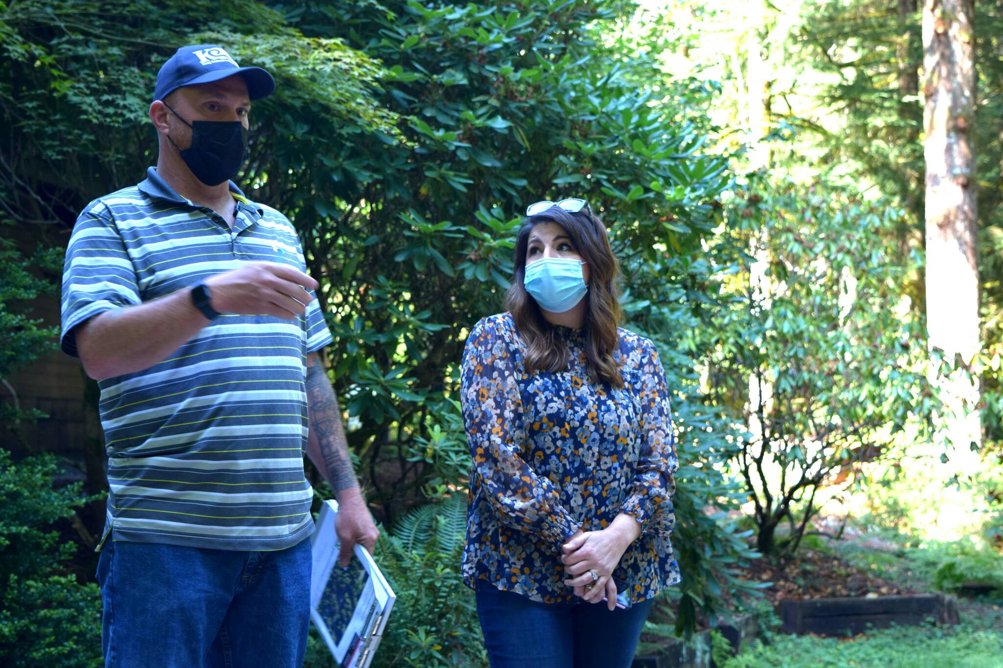
Matt Axe, the Wildfire and Forest Resiliency Coordinator with the King County Conservation District, speaks to homeowner Anita Kissee-Wilder about fire reduction strategies at her home in North Bend on Aug. 24, 2021. Photo by Conor Wilson/Valley Record
