Less blue on the FEMA food insurance rate map means good news for Kent
Published 3:11 pm Friday, April 29, 2011
The blues are beginning to lift in Kent because of a map.
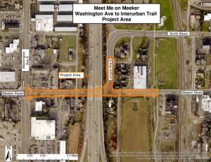
Kent Public Works Director Tim LaPorte announced in a release April 5 the city will be using a FEMA or Federal Emergency Management Agency flood insurance rate map from May 16, 1995 rather than FEMA’s updated map.
What this means in simplest terms is there is a lot less blue on the map or areas of potential flooding, which should improve insurance rates and help Kent join the slow walk to economic recovery.
The rate map FEMA was using did not acknowledge the existence of the levees around the city because they did not meet accreditation requirements. The FEMA rate map is often referred to as the without-levee rate map.
The maps are used as the primary regulatory tool under the National Flood Insurance Program and by the insurance industry to regulate floodplain development and rate flood-insurance policies.
The direct result of using the without-levee rate map was a lot blue, and according to LaPorte it was not an accurate picture of the flood threat.
“Now we have great news,” said Michelle Witham, city community and public affairs manager. “FEMA
has agreed to look at the levees again.”
LaPorte said his job is, “to separate a virtual threat from a real threat.”
In his release, LaPorte noted in 2007 FEMA decided the entire Kent valley was a floodplain. The FEMA maps based on the without levee modeling was appealed by King County, Kent, Auburn, Tukwila and Renton in March 2008.
LaPorte said the without-levees model was used in “areas where levees historically had not experienced any substantial failures.”
FEMA accepted the appeal and the agency’s staff was in the process of a developing a new rate map when FEMA Administrator Craig Fugate announced March 10 the brakes were being put on the without-levee approach and the modeling for flood hazard areas like the Kent valley will be reviewed and a replaced with a new method of analysis.
LaPorte stated the change at FEMA was prompted by a request from, “27 U.S. Senators and 49 members of Congress that opposed FEMA’s standard modeling approach that assumed non-accredited levees, including many Kent levees, did not exist at all.”
Fugate wrote in a letter to U.S. Sen. Thad Cochran from Mississippi, “In order to increase the credibility of our Flood Insurance Rate Maps in areas where levees are not accredited, I have directed my staff to replace the “without levee” modeling approach with a suite of methodologies that are technically sound, credible, and cost-effective. The approach will better meet the needs of our citizens while providing more precise results that better reflect the flood risks in areas impacted by levees.”
LaPorte said the Fugate decision, “buys time for the city to get levees certified. When the levees are certified we will not have the problem with the blue map.”
The blue map hurt real estate values, made purchasing flood insurance difficult or very expensive, securing business and home loans were impacted and economic development in the valley was stalled.
Witham said reverting to the 1995 rate map means, “now we are back. What is important for Kent is the ability to participate in the economic recovery.”
Witham said a “perfect storm” developed after the Hurricane Katrina slammed into the Gulf Coast in 2005. The failure of the levee system in New Orleans during the hurricane caused widespread death and destruction. Following Katrina, FEMA began looking at all the levees across the United States, including those in the Kent valley.
As FEMA began checking the levees around the country, news broke from the Army Corps of Engineers in 2009 that a depression or sinkhole was found in the earth and rock Howard Hanson Dam on the upper reaches of the Green River. The Corps stated it may have to release water to protect the dam and suddenly the perfect storm of an increase threat of flooding in the valley, questions about the levees and the Great Recession hit Kent with a series of body blows.
Now that FEMA has given the city some breathing room, the repairs to the dam are underway and the process of certifying the levees is moving forward, the blues appear to be lifting.